On the water · Pascagoula River
riverPaddling the rivers and bayous
Slow brown rivers, white sandbars and dark cypress bayous make the Mississippi coast a fine place to paddle, as long as you respect the current, the heat and the weather.
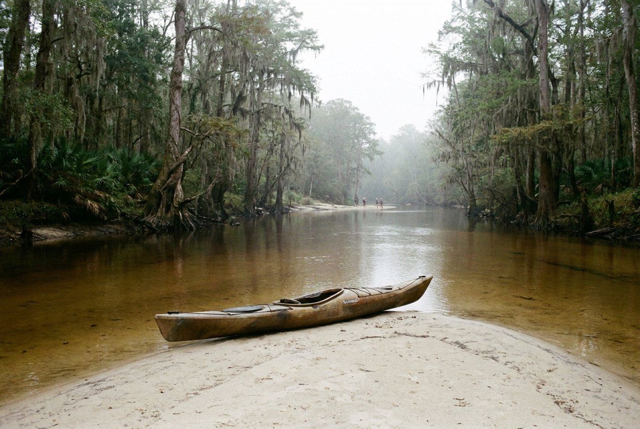
The Mississippi coast is laced with water that is good to paddle. The Pascagoula, often described as the largest river system in the contiguous United States without a dam on its main stem, winds through miles of swamp to the sound. Its tributaries, among them Red Creek and Black Creek, run clear-brown over sand through pine and hardwood forest. Closer to the beach, the Wolf, the Jourdan, the Tchoutacabouffa and dozens of bayous wind through marsh and cypress to the bays. You can spend a morning on a quiet bayou or several days on a river, camping on sandbars.
This guide covers the basics: the kinds of water you will meet, how current and rising water behave, and how to stay safe and leave little behind. It is not a route guide. Conditions change from season to season and even from week to week, so treat every trip as new and check the river before you commit to it.
The waters
The upper creeks are narrow, fast in places and full of bends, with white sandbars on the inside of each curve and fallen trees on the outside. Black Creek, in the De Soto National Forest, is Mississippi's only federally designated wild and scenic river, and it is a classic multi-day trip. Red Creek is similar in character. These creeks rise and drop quickly with rain.
The main Pascagoula is broad and slow, with big sandbars in dry seasons and deep swamp on both banks. Lower down it splits into channels and bayous through the cypress and tupelo swamps, and the water starts to feel the tide. Near Moss Point and Pascagoula the river becomes a working waterway with industry, barges and larger boats. Read our guide to the Pascagoula River for the wider story.
The coastal bayous are slow, dark and winding, with marsh grass, cypress and oaks on the banks. They are good for short trips and for watching birds, and many have a public launch. On the open bays and the sound, though, the water is a different game: wind builds waves quickly over shallow water, and boat traffic is heavier.
Current, sandbars and rising water
River current here is usually gentle, but it is steady and strongest on the outside of bends, where it pushes toward fallen trees and logjams. These strainers let water through but not a boat or a person, and they are the main danger on the creeks. Stay to the inside of bends, look well ahead, and get out and walk your boat around a blockage if you cannot see a clear line.
Sandbars are the reward. On a dry day the creeks and the main river expose long beaches of fine white sand, ideal for a rest or a swim in a slow eddy. Check the bottom before you jump, and keep a life jacket on in the current.
The most important rule on these rivers is to watch the water level. Heavy rain upstream can raise a creek several feet in a day, and the rise may come after the rain has stopped where you are. Fast water hides strainers and covers the sandbars where you might have planned to camp. Check the river gauges before you go, make sure someone knows your plan and your take-out time, and do not start a trip when the river is high or rising. If the water comes up while you are out, camp high and move only when you can see a safe line.
Further down the waterInside the cypress and tupelo swampHeat, storms and insects
In summer, heat is the real hazard. The sand reflects the sun, the air is humid, and there is little shade in the middle of a wide river. Start early, rest in shade in the middle of the day, and drink often. Carry spare water and some way to treat river water if you are out for longer.
Afternoon thunderstorms are common from late spring to early autumn. Lightning on open water is dangerous; when you hear thunder, get off the water, away from tall lone trees, and wait. Tropical storms can come any time from June into November, and you should never be on a river with a tropical storm in the forecast.
Mosquitoes, deer flies and gnats can be fierce in the warm months, especially near the marsh at dusk. Long sleeves and repellent help.
The most important rule on these rivers is to watch the water level.
Alligators, snakes and sharing the water
Alligators live in the rivers, swamps and bayous, and you may see one on a bank or sliding into the water. They usually keep their distance from people. Do not approach them, never feed them, and keep well away from nests and from small alligators, which may have a protective mother nearby. Keep pets out of the water in alligator areas.
Venomous snakes, including cottonmouths and copperheads, also live here. Watch where you put your hands and feet when you climb out at the bank or step over logs, and give any snake room to move away. Most bites happen when people try to handle or kill a snake.
On the lower river and in the bays you share the water with fishing boats and larger traffic. Stay near the edges, wear bright colors, and cross channels quickly at a right angle.
Leaving no trace
Much of the land along these rivers is public, protected or private, and the rules differ. Before you camp, check whether camping on sandbars or banks is allowed where you plan to stop. Pack out everything you carry in, including food scraps. Use existing fire rings if fires are allowed, keep fires small and on the open sand, and put them out completely with water. Carry a way to deal with human waste properly, and never leave it near the water.
Leave wildflowers, shells and old bottles where you find them, and keep noise down; much of the pleasure of these rivers is in the quiet. Nearby trips include the bayous around Davis Bayou in Ocean Springs and the river through Moss Point.
Planning a trip
A few practical notes for planning:
- Always wear a life jacket, and make sure everyone in the group can swim.
- Arrange your shuttle before you start; many put-ins and take-outs are far apart by road.
- Check river levels, weather and any closures with the managing agency before you set out.
- Carry a map, a phone in a waterproof bag, and a whistle.
- Plan short days at first: the river can be slower than you expect, and sandbars invite long stops.
Paddled with care, these rivers give you something hard to find on most coasts: long stretches of wild water, few people, birds at every bend, and a white sandbar to yourself at the end of the day.