Seasons and weather · Mississippi Gulf Coast
gulfHurricane season, plainly
Six months of the year carry a real risk on this coast. Here is what the season looks like, what the coast remembers, and how to read the forecasts calmly.
The Atlantic hurricane season runs officially from the first of June to the end of November. Those dates are a frame, not a promise: most years pass with no storm reaching the Mississippi coast at all, and some years bring more than one. The busiest stretch for the whole basin is from mid-August into October, with the peak usually counted around early to mid-September. Early-season storms in June and July tend to be weaker and messier, and late storms in November are rare but not unknown.
None of this should keep you off the coast in summer. It should shape how you plan. If you come between August and October, keep your dates flexible where you can, watch the forecast in the week before you travel, and know that you may need to leave early.
Why this coast floods
The Mississippi shore is short, low and faces almost due south across a shallow sound. The barrier islands sit about ten miles offshore, and between them and the mainland the water is rarely deep. When a strong storm comes ashore just to the west, its winds push Gulf water north into the sound and pile it against the beach, into the bays and up the bayous and rivers. That rising water, the storm surge, is what the coast fears most. It can arrive fast, carry debris like a battering ram, and reach streets and houses that are a long way from the sand.
Rain is the other half. A slow storm can drop many inches over the coastal counties and over the river basins inland, and the Pascagoula, the Wolf and the Jourdan rise for days after the wind has gone. Flooding along the rivers can peak well after the storm has left the news.
Camille, 1969
For a generation, Camille was the measure of everything. It came ashore on the night of August 17, 1969, near the western end of the coast around Waveland and Bay St. Louis, as one of the most intense hurricanes ever to strike the United States. Its surge swept the beachfront from Waveland to Biloxi, and its winds stripped trees and flattened buildings well inland.
Camille also changed the map offshore. It cut Ship Island in two, and the gap it opened, still called the Camille Cut, is why the island is now spoken of as West and East Ship Island. On the mainland, many people who had ridden out earlier storms at home took Camille as proof that a house that survived one hurricane would survive the next. Katrina showed how dangerous that lesson was.
Katrina, 2005
Hurricane Katrina made its final landfall on August 29, 2005, near the mouth of the Pearl River on the Louisiana and Mississippi line. It was a very large storm, and the right side of it, the side with the strongest onshore push, lay over the Mississippi coast. The surge here was higher than Camille's, well over twenty feet in places, and it reached farther inland than many people believed water could.
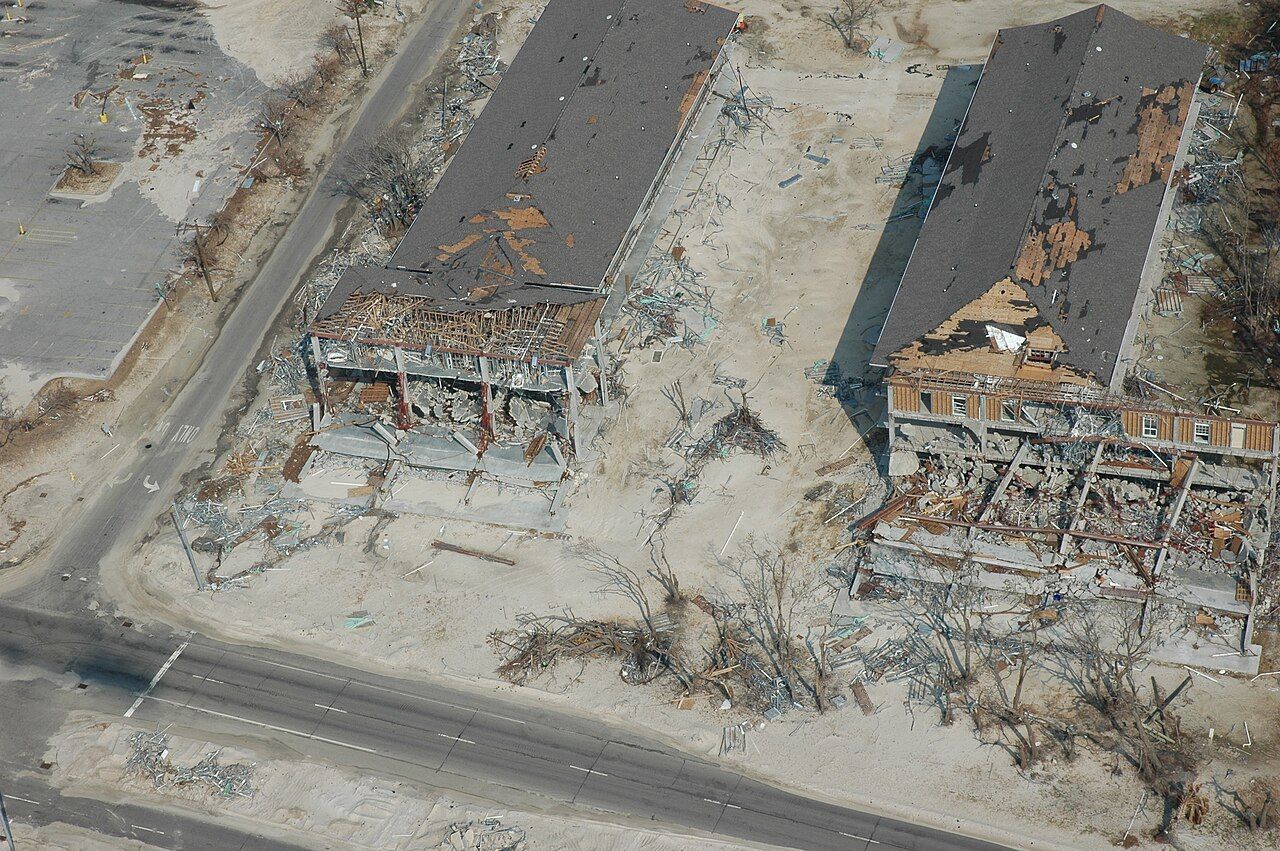
Whole blocks of homes along the beach in Waveland, Bay St. Louis, Pass Christian, Long Beach, Gulfport and Biloxi were reduced to slabs. The bridges carrying US 90 across the Bay of St. Louis and Biloxi Bay were wrecked and later rebuilt. The coast has spent the years since rebuilding, often higher and farther back, and you can still read the storm in the landscape: empty lots facing the beach, steps leading to nothing, houses raised on tall pilings. If you walk the waterfront in Bay St. Louis or Biloxi, you are walking through that recovery.


Biloxi keeps a memorial on its Town Green near the beach. Its black granite wall is built to the height the water reached there, and it lists names of those who died. Stand next to it for a minute, then look toward the Gulf. It explains the surge better than any number.
Further down the waterBay St. Louis and the western shoreWatches, warnings and the cone
The National Hurricane Center and the local National Weather Service office issue the forecasts that matter. A few terms are worth knowing before you arrive:
- Hurricane or tropical storm watch: those conditions are possible in the area, usually issued about two days before strong winds are expected.
- Hurricane or tropical storm warning: those conditions are expected, usually issued about a day and a half ahead. By the time a warning is up, it is late to start making plans.
- Storm surge watch and warning: a separate alert for life-threatening rising water, which can be issued even when the wind forecast looks modest.
- The cone: the forecast map shows where the center of the storm may go, not how wide the storm is. Damage, surge and heavy rain regularly reach far outside it.
The strength category describes wind only. A weaker, slower or larger storm can still bring a dangerous surge and serious flooding, so do not judge a storm by its number.
If a storm comes while you are here
Follow official advice, and follow it early. County emergency managers decide on evacuations, often by zone, starting with low ground, the beachfront, mobile homes and places along the bayous. If you are a visitor, you do not need to wait for an order that names your street: if a hurricane is forecast for the coast, the simplest choice is to leave while roads are clear and fuel is easy to find.
The main routes out run north, away from the water: US 49 from Gulfport toward Hattiesburg, Highway 63 north from the Pascagoula area, Highway 15 and Highway 67 from the Biloxi side, and Interstate 10 east and west. Traffic builds quickly once an evacuation begins, so go sooner rather than later. Keep the tank full when a storm is in the forecast, keep your phone charged, and carry any medicine you need.
Do not drive through flooded roads; water hides washed-out pavement and moves cars easily. After a storm, stay away from downed lines and wait for officials to say an area is open before you return. Beaches can carry dangerous rip currents for days before and after a storm passes offshore, even under a blue sky, and boats should stay in harbor well ahead of the weather. Trips to the barrier islands, including the seasonal ferry to Ship Island, stop when weather threatens.
The rest of the season
Most summer days on the coast are simply hot and humid, with afternoon thunderstorms that build over the land and roll out over the sound. Lightning is the everyday hazard: get off the water and the beach when you hear thunder, and wait a while after the last rumble before you go back. The calmer, drier days usually return as October turns to November, which is one reason many people find late autumn one of the best times on the coast. Our guide to the coast through the year covers the rest.
Hurricanes are part of life here, and people on this coast talk about them plainly. Come in season if you like, keep an eye on the forecast, and be ready to change your plans. That is what the people who live here do every year.